

Blog
Atmospheric River Slams Southern California With Heavy Rainfall: A Traveler’s View From Interstate 10
Atmospheric River Slams Southern California: A powerful atmospheric river dropped record rainfall across Southern California on November 15, 2025, with Oxnard hitting 3.18 inches and inland areas exceeding 4 inches. During a drive from Ontario to Phoenix, we witnessed more than ten accidents on I-10 caused largely by reckless behavior in dangerous conditions. Here’s the full storm update, rainfall totals, and what this extreme weather teaches us about safe driving.
Last Updated on November 16, 2025 by Rod Washington
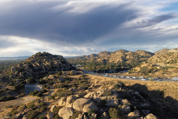
View of Stoney Point Park and Topanga Canyon Blvd in the Chatsworth neighborhood of Los Angeles, California.
Atmospheric River Slams Southern California With Heavy Rainfall: A Traveler’s View From Interstate 10
Driving Through a Storm: What We Learned From SoCal’s November Deluge
On Saturday, November 15, 2025, we made the decision to leave California and head back to Phoenix — but not before being swallowed by one of the most intense storms I’ve experienced in years. As we pulled out from Ontario on Interstate 10, the sky darkened, and what began as a routine drive turned into a lesson on risk, responsibility, and shared danger.
A Storm Like No Other
This was no simple rainstorm. It was a powerful atmospheric river, pushing deep moisture across Southern California and dumping historic amounts of rain:
Oxnard (Ventura County): 3.18 inches — a record-setting single day.
Santa Barbara Airport: 2.90 inches in one day, and upwards of 6 inches over several days in some areas.
San Antonio Heights / Cucamonga Canyon: Inland gauges saw 4+ inches in just a short time.
Ontario / I-10 Corridors: Our route wasn’t spared — roughly 1.9 inches was recorded near Ontario Airport, though I felt the ferocity of far more intense rain.
These numbers tell you part of the story — but not the whole thing. Rain intensity, how fast it fell, and where it fell mattered just as much.
When the Road Became Dangerous
Traveling east on I-10, between West Covina and Indio, we passed at least ten accidents. Given how sudden and brutal the rain was, it’s not surprising: water pooling, visibility drops, and drivers unsure how to react can combine dangerously.
Here’s what stood out:
Some drivers did everything right: slowing down, flashing their hazard lights, switching lanes carefully when they saw standing water.
Others, though, acted as if they were immune to the flooding: speeding, swerving, tailgating, even deliberately splashing slower cars. Sadly, many of those behaviors contributed directly to crashes. We saw firsthand that reckless driving didn’t just affect the risk-takers — it also hurt people who were being cautious.
Why This Storm Was Especially Risky
Soil Saturation & Burn Scars
Areas burned by recent wildfires (hillsides in L.A. and Ventura) were a major concern. The soil was already saturated, and rain ran off steep slopes quickly — making debris flows a real threat.
High Rain Rates
Even if a station only recorded a few inches total, some of this rain came down very fast. That gives very little time for water to drain — increasing the likelihood of flash floods.
Traffic Hazards
On major corridors like I-10, low spots and drainage pinch points filled up fast. For someone driving, that means hidden water, hydroplaning risk, and less stopping margin.
Driving Out of the Storm: A Personal Look at Safety and Chaos on Interstate 10
What We Can Learn (and What to Do)
Drive like the conditions are worse than they seem. Even if rainfall totals look moderate, high rain rates or localized flash flooding can catch you off guard.
Use your hazard lights when visibility drops. It helps others see you, and it’s a sign you’re being cautious, not careless.
Don’t tailgate or speed. In rain, safe distance matters more than ever.
Slow down proactively. The best response to heavy rain is to brake early, not hard.
Be especially alert near hills / burn areas. Water may be running off slopes, and debris or loose rock can get carried into the roadway.
Storms like November’s atmospheric river are reminders — nature can humble any road trip. But it’s not just about rain or weather. It’s about how we treat one another when conditions go sideways. On a day when many drivers banded together to navigate safely, there were still too many who refused to adapt — and we saw exactly how risky that can be.
As the storm moves off and skies clear, the danger doesn’t disappear instantly. Saturated soils, weakened slopes, and hidden pools of water persist. For anyone traveling now — especially through canyons, foothills, and low freeway spots — cautious driving, respect for others, and shared responsibility remain the best tools to stay safe.
🔗 Sources
Dive into “The Knowledge,” where curiosity meets clarity. This playlist, in collaboration with STMDailyNews.com, is designed for viewers who value historical accuracy and insightful learning. Our short videos, ranging from 30 seconds to a minute and a half, make complex subjects easy to grasp in no time. Covering everything from historical events to contemporary processes and entertainment, “The Knowledge” bridges the past with the present. In a world where information is abundant yet often misused, our series aims to guide you through the noise, preserving vital knowledge and truths that shape our lives today. Perfect for curious minds eager to discover the ‘why’ and ‘how’ of everything around us. Subscribe and join in as we explore the facts that matter. https://stmdailynews.com/the-knowledge/


