

Urbanism
Discover the Rich History and Vibrant Community of Lynwood, California
Last Updated on October 5, 2025 by Daily News Staff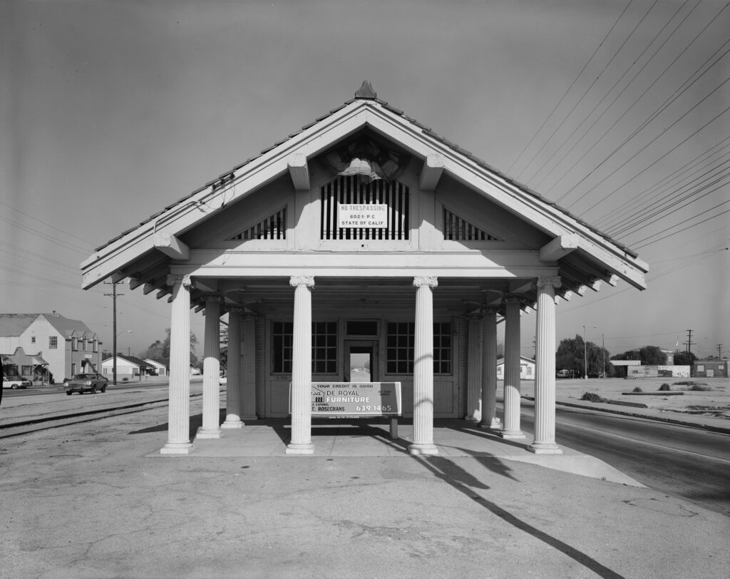
The city of Lynwood, located in Los Angeles County, California, has a rich history that dates back to the days of Spanish colonization. The area was first settled by Spanish aristocrats and American pioneers who formed a small communal town in the region. One of the key figures in Lynwood’s history was Don Antonio Maria Lugo, who was awarded a large tract of land by the king of Spain in 1810 for his military service during the establishment of the Spanish missions in California.
Lugo named the area Rancho San Antonio, which later became the bordering cities of Bell, Bell Gardens, Commerce, Cudahy, Huntington Park, Lynwood, Maywood, Montebello, South Gate, Vernon, and Walnut Park. Over the years, Lynwood underwent a transformation, evolving from a majority white non-Hispanic community to a diverse city with a growing Latino population. In 1983, Lynwood elected its first Black councilmember, and in 1985, its first Black mayor, Robert Henning. The political landscape continued to evolve with the election of the first Latino mayor, Armando Rea, in 1997.
However, not all moments in Lynwood’s history were positive. In 2006, the city’s longest-serving former mayor, Paul H. Richards II, was sentenced to federal prison for corruption charges. Richards had been convicted of funneling city business to a consulting company controlled by him and his family. Despite this setback, Lynwood continued to grow and prosper.
Hey Lynwood, I feel good!
Today, Lynwood is a bustling city with major transportation routes running through it, including the Long Beach Freeway and the Century Freeway. The city is served by the Los Angeles County Fire Department and the Los Angeles County Sheriff’s Department. Lynwood is also represented in the state government by Assemblyman Anthony Rendon and Senator Ricardo Lara, as well as in the United States House of Representatives by Congresswoman Nanette Barragán.
The city of Lynwood operates several parks, providing recreational opportunities for its residents. These parks include Lynwood Park, Ham Park, and Yvonne Burke-John D. Ham Park. The recreational facilities offer sports fields, playgrounds, and picnic areas, making them popular spots for families and community events. Its educational system is served by the Lynwood Unified School District, with high schools such as Lynwood High School and Marco Antonio Firebaugh High School. The district works to provide quality education and numerous extracurricular activities for its students, shaping the future generations of Lynwood.
Major employers in Lynwood include St. Francis Medical Center, which provides essential healthcare services to the community, and the Earle M. Jorgensen Company, a leading metals distributor. These employers play a critical role in Lynwood’s economy and offer numerous job opportunities to its residents.
Lynwood also has strong ties to its sister cities in Mexico, including Aguascalientes, Zacatecas, and Talpa de Allende. These sister city relationships foster cultural exchange and mutual understanding. The city has produced notable individuals who have achieved national and international recognition. Tennis player Venus Williams spent part of her childhood in Lynwood and went on to become one of the greatest female tennis players in history. Musician “Weird Al” Yankovic, known for his humorous parodies of popular songs, also hails from Lynwood. Additionally, actor and director Kevin Costner, whose work includes acclaimed films such as “Dances with Wolves” and “Field of Dreams,” grew up in Lynwood.
These distinguished individuals have made a lasting impact on Lynwood’s history and continue to inspire future generations in the city. Lynwood’s community spirit, cultural diversity, and ongoing development make it a dynamic and vibrant place to live, work, and visit.
https://en.wikipedia.org/wiki/Lynwood,_California
https://stmdailynews.com/category/stm-blog/blog/


Few transportation systems in the world are as instantly recognizable as the cable cars of San Francisco. Climbing steep hills with a steady hum and a nostalgic charm, these moving landmarks are more than just a tourist attraction—they’re a triumph of innovation born out of necessity.
🐎 A Problem on the Hills
In the mid-1800s, San Francisco was growing rapidly, but its geography posed a serious challenge. The city’s steep inclines made travel difficult, especially for horse-drawn streetcars, which were the primary form of public transportation at the time.
Horses often struggled to pull heavy loads uphill, and accidents were common. In some cases, animals collapsed under the strain. This dangerous and inefficient system needed a solution.
💡 The Vision of Andrew Hallidie
That solution came from Andrew Smith Hallidie, an engineer and entrepreneur who envisioned a safer, more reliable way to move people through the city.
Hallidie developed a system in which streetcars would be pulled by a continuously moving cable running beneath the street—eliminating the need for horses altogether.
⚙️ The First Cable Car Line
On August 2, 1873, Hallidie launched the world’s first cable car system: the Clay Street Hill Railroad.
This groundbreaking line proved that cable-powered transit could successfully navigate San Francisco’s steep terrain. Instead of relying on animal power, cars used a mechanical grip to latch onto a moving cable underground, allowing them to glide smoothly up and down hills.
The innovation quickly captured public attention—and demand.
🚀 A City Transformed
Following the success of the Clay Street line, cable car systems spread rapidly across San Francisco.
By the late 19th century:
- Dozens of routes crisscrossed the city
- Cable cars became the backbone of urban transportation
- The system helped shape the city’s growth and accessibility
For a time, San Francisco operated the largest and most advanced cable car network in the world.
⚡ The Rise of Electric Streetcars
Despite their success, cable cars faced competition from emerging electric streetcar systems in the early 20th century. Electric trolleys were cheaper to build and operate, and they didn’t require the complex underground cable infrastructure.
The turning point came after the devastating 1906 San Francisco earthquake, which destroyed much of the city—including large portions of the cable car network.
When rebuilding began, many lines were converted to electric systems instead of restoring the older cable technology.
San Francisco’s cable car system, first launched in 1873, remains the last manually operated system of its kind. According to the San Francisco Municipal Transportation Agency (SFMTA) , the system was designed to safely navigate the city’s steep terrain.
The cable cars are now designated as a National Historic Landmark, recognized for their cultural and engineering significance by the National Park Service .
Visitors can explore the history and mechanics of the system at the San Francisco Cable Car Museum , which preserves original equipment and archives.
🛑 Saving a Symbol
By the 1940s, cable cars were on the brink of extinction.
That’s when Friedel Klussmann stepped in. A passionate preservationist, Klussmann led a public campaign to protect the remaining lines from being dismantled.
Her efforts culminated in a successful 1947 voter referendum that ensured the survival of San Francisco’s cable cars—transforming them from everyday transit into a preserved cultural landmark.
🌉 Cable Cars Today
Today, San Francisco’s cable cars are:
- The last manually operated cable car system in the world
- A National Historic Landmark
- One of the most visited attractions in California
Three lines remain in operation:
- Powell–Hyde Line
- Powell–Mason Line
- California Street Line
While they still function as public transit, they now serve as a moving museum—connecting modern riders with the city’s past.
🎯 Why It Matters
San Francisco’s cable cars represent more than a mode of transportation. They tell a story of innovation, resilience, and community action.
From solving a practical problem to becoming a global icon, the cable car system reflects how cities adapt—and how people fight to preserve what makes them unique.
📌 “Now You Know”
San Francisco’s cable cars weren’t built for tourism—they were invented to solve a life-and-death problem on steep city streets. Today, they remain the last system of their kind anywhere in the world.
🔗 External Sources & Related Links
- SFMTA – Cable Cars Overview
- San Francisco Cable Car Museum
- National Park Service – Historic Landmark Info
- Britannica – Cable Car History
- History.com – Invention of Cable Cars
Explore the latest in innovation, AI, gadgets, startups, and digital trends in STM Daily News’ Techsection.
Transportation
California High-Speed Rail Reaches Major Milestone as Track Installation Nears
California High-Speed Rail project reaches a major milestone with over 80 miles of guideway completed and track installation approaching. Learn what this means for the future of high-speed rail in the United States.
For years, California’s High-Speed Rail project has been the subject of debate, delays, and soaring cost estimates. Yet despite the challenges, the state’s ambitious effort to build America’s first true high-speed rail system has reached a significant milestone that signals tangible progress.
According to the California High-Speed Rail Authority, more than 80 miles of guideway structures have now been completed across the Central Valley, with active construction underway on approximately 119 miles of the future rail corridor. The project has also completed dozens of major infrastructure structures, including bridges, viaducts, and grade separations designed to carry trains traveling at speeds of up to 220 mph.
Perhaps the most important milestone is what comes next: track installation. After years of earthmoving, bridge construction, and utility relocation, the project is transitioning from building the pathway to building the railroad itself. This shift marks one of the clearest signs yet that the long-discussed system is moving closer to becoming operational.
Building the First Operating Segment
Current efforts are focused on creating an initial operating segment connecting Merced and Bakersfield through California’s Central Valley. Once completed, the line will serve communities including Merced, Fresno, Kings County, Tulare County, and Bakersfield.
The first operating segment is expected to span approximately 171 miles and is targeted for passenger service in the early 2030s. While this initial section does not yet connect the Bay Area or Los Angeles, state officials view it as a critical foundation for future expansion.
A Vision Decades in the Making
California voters approved funding for high-speed rail in 2008 with the vision of linking San Francisco and Los Angeles through a fast, environmentally friendly transportation system. Since then, the project has faced legal challenges, political opposition, funding uncertainties, and rising construction costs.
Supporters argue that the project will reduce highway congestion, lower greenhouse gas emissions, create jobs, and provide a modern transportation alternative for one of the nation’s most populated states.
Critics continue to question the project’s overall cost and timeline, particularly regarding future extensions to major metropolitan areas.
Why This Milestone Matters
Large infrastructure projects often progress slowly and out of public view. The completion of major structures and the upcoming installation of track represent visible signs that California’s high-speed rail system is advancing beyond planning and engineering.
While significant work remains before passengers can board a train, the project has entered a new phase—one focused on turning years of construction into a functioning rail network.
For Californians who have followed the project since its inception, this milestone serves as a reminder that despite setbacks and controversy, the state’s high-speed rail vision is steadily taking shape across the Central Valley.
As construction continues, the coming years will determine whether this first operating segment can become the launching point for a statewide high-speed transportation system connecting California’s largest cities.
Learn More About High-Speed Rail and Transportation Infrastructure
- California High-Speed Rail Authority Project Overview
- California High-Speed Rail Construction Updates
- Federal Railroad Administration: High-Speed Rail Information
- Brightline West: High-Speed Rail Connecting Southern California and Las Vegas
- Amtrak: America’s Passenger Rail Network
Source:
The California High-Speed Rail Authority (HSRA) project updates and 2026 Business Plan.
STM Daily News is a vibrant news blog dedicated to sharing the brighter side of human experiences. Emphasizing positive, uplifting stories, the site focuses on delivering inspiring, informative, and well-researched content. With a commitment to accurate, fair, and responsible journalism, STM Daily News aims to foster a community of readers passionate about positive change and engaged in meaningful conversations. Join the movement and explore stories that celebrate the positive impacts shaping our world.
Urbanism
LA Metro’s D Line Extension Phase 1 Officially Opens, Bringing Subway Service to Mid-Wilshire and Beverly Hills
LA Metro’s D Line Extension: LA Metro officially opens Phase 1 of the D Line Subway Extension, connecting Downtown Los Angeles, Mid-Wilshire, and Beverly Hills with three new underground stations.
The future of transportation in Los Angeles has officially arrived.
LA Metro’s D Line Extension Phase 1 Officially Opens
The Los Angeles County Metropolitan Transportation Authority (Metro) officially opened Section 1 of the long-awaited D Line Subway Extension on May 8, 2026, expanding underground rail service westward through the historic Mid-Wilshire corridor and into Beverly Hills.
The 3.92-mile extension is one of Metro’s most ambitious transit infrastructure projects and marks a major milestone in Los Angeles public transportation. The new section extends subway service beyond the current Wilshire/Western station in Koreatown and introduces three new underground stations:
- Wilshire/La Brea
- Wilshire/Fairfax
- Wilshire/La Cienega
The expansion is part of Metro’s larger “Twenty-Eight by ’28” initiative designed to improve mobility across the region ahead of the 2028 Olympic and Paralympic Games.
Downtown Los Angeles to Beverly Hills in About 20 Minutes
With the extension now open, riders can travel from Union Station in Downtown Los Angeles to Beverly Hills in approximately 20 minutes with no transfers required.
The D Line extension is expected to significantly improve travel along the heavily congested Wilshire Boulevard corridor, offering commuters, visitors and residents a faster and more reliable alternative to driving.
“Traveling through Mid-Wilshire to experience the culture, cuisine and commerce across diverse neighborhoods will be easier, faster and more accessible,” said Fernando Dutra, Metro Board Chair and City of Whittier Council Member.
Metro CEO Stephanie Wiggins also highlighted the importance of the project in connecting Angelenos to some of the city’s most iconic destinations.
“Angelenos and visitors alike will love the extended service from Downtown Los Angeles to Beverly Hills, delivering greater access to the iconic and culturally diverse communities, institutions and destinations that define the deep history along Wilshire Boulevard,” Wiggins said.
New Stations Connect Riders to Cultural Landmarks
Wilshire/La Brea Station
Located near Hancock Park and the western edge of Koreatown, the station provides access to cultural and entertainment destinations including:
- Korean Cultural Center
- Marciano Art Foundation
- Ebell Theater
- Popular restaurants including Republique and Sycamore Kitchen
Wilshire/Fairfax Station
Known as the heart of Museum Row, this station serves some of Los Angeles’ most recognizable cultural institutions and attractions, including:
- Los Angeles County Museum of Art (LACMA)
- Academy Museum of Motion Pictures
- Petersen Automotive Museum
- La Brea Tar Pits
- The Grove
- Original Farmers Market
The station also connects neighborhoods including Little Ethiopia, Park La Brea and the historic Fairfax District.
Wilshire/La Cienega Station
Serving as the eastern gateway to Beverly Hills, the station provides convenient access to Restaurant Row and destinations including the Beverly Center.
A Major Milestone for Los Angeles Transit
The D Line extension has been decades in the making and is widely considered one of the most important transit projects in Los Angeles history.
The project was funded primarily through Measure R, the voter-approved transportation sales tax passed in 2008, along with substantial federal funding support that included:
- $1.25 billion Full Funding Grant Agreement (FFGA)
- $66.4 million supplemental New Starts funding
- $749.3 million TIFIA loan
All three stations feature modern amenities including public artwork, enhanced lighting, cell phone service, bicycle hubs and improved pedestrian access.
Metro officials hope the extension will encourage more residents and visitors to use public transportation while helping reduce roadway congestion ahead of major international events scheduled for Los Angeles later this decade.
What’s Next for the D Line?
Construction is already underway on future phases of the D Line extension.
Phase 2 will continue west into Beverly Hills and Century City, while Phase 3 will eventually extend subway service to UCLA and the West Los Angeles VA campus.
Once completed, the D Line will provide a direct subway connection between Downtown Los Angeles and the Westside, dramatically reshaping mobility across one of Southern California’s busiest corridors.
Learn More
For official project details and station information, visit:
Metro D Line Opening Information
Stay connected with STM Daily News for the latest updates on Los Angeles transportation, Metro expansion projects, infrastructure developments, local news, technology, culture, and more. Visit STM Daily News for breaking stories, in-depth coverage, and exclusive content from across Southern California and beyond.


