

Blog
Atmospheric River Slams Southern California With Heavy Rainfall: A Traveler’s View From Interstate 10
Atmospheric River Slams Southern California: A powerful atmospheric river dropped record rainfall across Southern California on November 15, 2025, with Oxnard hitting 3.18 inches and inland areas exceeding 4 inches. During a drive from Ontario to Phoenix, we witnessed more than ten accidents on I-10 caused largely by reckless behavior in dangerous conditions. Here’s the full storm update, rainfall totals, and what this extreme weather teaches us about safe driving.
Last Updated on November 16, 2025 by Rod Washington
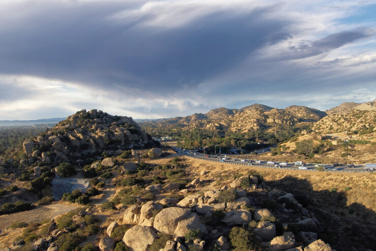
View of Stoney Point Park and Topanga Canyon Blvd in the Chatsworth neighborhood of Los Angeles, California.
Atmospheric River Slams Southern California With Heavy Rainfall: A Traveler’s View From Interstate 10
Driving Through a Storm: What We Learned From SoCal’s November Deluge
On Saturday, November 15, 2025, we made the decision to leave California and head back to Phoenix — but not before being swallowed by one of the most intense storms I’ve experienced in years. As we pulled out from Ontario on Interstate 10, the sky darkened, and what began as a routine drive turned into a lesson on risk, responsibility, and shared danger.
A Storm Like No Other
This was no simple rainstorm. It was a powerful atmospheric river, pushing deep moisture across Southern California and dumping historic amounts of rain:
Oxnard (Ventura County): 3.18 inches — a record-setting single day.
Santa Barbara Airport: 2.90 inches in one day, and upwards of 6 inches over several days in some areas.
San Antonio Heights / Cucamonga Canyon: Inland gauges saw 4+ inches in just a short time.
Ontario / I-10 Corridors: Our route wasn’t spared — roughly 1.9 inches was recorded near Ontario Airport, though I felt the ferocity of far more intense rain.
These numbers tell you part of the story — but not the whole thing. Rain intensity, how fast it fell, and where it fell mattered just as much.
When the Road Became Dangerous
Traveling east on I-10, between West Covina and Indio, we passed at least ten accidents. Given how sudden and brutal the rain was, it’s not surprising: water pooling, visibility drops, and drivers unsure how to react can combine dangerously.
Here’s what stood out:
Some drivers did everything right: slowing down, flashing their hazard lights, switching lanes carefully when they saw standing water.
Others, though, acted as if they were immune to the flooding: speeding, swerving, tailgating, even deliberately splashing slower cars. Sadly, many of those behaviors contributed directly to crashes. We saw firsthand that reckless driving didn’t just affect the risk-takers — it also hurt people who were being cautious.
Why This Storm Was Especially Risky
Soil Saturation & Burn Scars
Areas burned by recent wildfires (hillsides in L.A. and Ventura) were a major concern. The soil was already saturated, and rain ran off steep slopes quickly — making debris flows a real threat.
High Rain Rates
Even if a station only recorded a few inches total, some of this rain came down very fast. That gives very little time for water to drain — increasing the likelihood of flash floods.
Traffic Hazards
On major corridors like I-10, low spots and drainage pinch points filled up fast. For someone driving, that means hidden water, hydroplaning risk, and less stopping margin.
Driving Out of the Storm: A Personal Look at Safety and Chaos on Interstate 10
What We Can Learn (and What to Do)
Drive like the conditions are worse than they seem. Even if rainfall totals look moderate, high rain rates or localized flash flooding can catch you off guard.
Use your hazard lights when visibility drops. It helps others see you, and it’s a sign you’re being cautious, not careless.
Don’t tailgate or speed. In rain, safe distance matters more than ever.
Slow down proactively. The best response to heavy rain is to brake early, not hard.
Be especially alert near hills / burn areas. Water may be running off slopes, and debris or loose rock can get carried into the roadway.
Storms like November’s atmospheric river are reminders — nature can humble any road trip. But it’s not just about rain or weather. It’s about how we treat one another when conditions go sideways. On a day when many drivers banded together to navigate safely, there were still too many who refused to adapt — and we saw exactly how risky that can be.
As the storm moves off and skies clear, the danger doesn’t disappear instantly. Saturated soils, weakened slopes, and hidden pools of water persist. For anyone traveling now — especially through canyons, foothills, and low freeway spots — cautious driving, respect for others, and shared responsibility remain the best tools to stay safe.
🔗 Sources
Dive into “The Knowledge,” where curiosity meets clarity. This playlist, in collaboration with STMDailyNews.com, is designed for viewers who value historical accuracy and insightful learning. Our short videos, ranging from 30 seconds to a minute and a half, make complex subjects easy to grasp in no time. Covering everything from historical events to contemporary processes and entertainment, “The Knowledge” bridges the past with the present. In a world where information is abundant yet often misused, our series aims to guide you through the noise, preserving vital knowledge and truths that shape our lives today. Perfect for curious minds eager to discover the ‘why’ and ‘how’ of everything around us. Subscribe and join in as we explore the facts that matter. https://stmdailynews.com/the-knowledge/


Few transportation systems in the world are as instantly recognizable as the cable cars of San Francisco. Climbing steep hills with a steady hum and a nostalgic charm, these moving landmarks are more than just a tourist attraction—they’re a triumph of innovation born out of necessity.
🐎 A Problem on the Hills
In the mid-1800s, San Francisco was growing rapidly, but its geography posed a serious challenge. The city’s steep inclines made travel difficult, especially for horse-drawn streetcars, which were the primary form of public transportation at the time.
Horses often struggled to pull heavy loads uphill, and accidents were common. In some cases, animals collapsed under the strain. This dangerous and inefficient system needed a solution.
💡 The Vision of Andrew Hallidie
That solution came from Andrew Smith Hallidie, an engineer and entrepreneur who envisioned a safer, more reliable way to move people through the city.
Hallidie developed a system in which streetcars would be pulled by a continuously moving cable running beneath the street—eliminating the need for horses altogether.
⚙️ The First Cable Car Line
On August 2, 1873, Hallidie launched the world’s first cable car system: the Clay Street Hill Railroad.
This groundbreaking line proved that cable-powered transit could successfully navigate San Francisco’s steep terrain. Instead of relying on animal power, cars used a mechanical grip to latch onto a moving cable underground, allowing them to glide smoothly up and down hills.
The innovation quickly captured public attention—and demand.
🚀 A City Transformed
Following the success of the Clay Street line, cable car systems spread rapidly across San Francisco.
By the late 19th century:
- Dozens of routes crisscrossed the city
- Cable cars became the backbone of urban transportation
- The system helped shape the city’s growth and accessibility
For a time, San Francisco operated the largest and most advanced cable car network in the world.
⚡ The Rise of Electric Streetcars
Despite their success, cable cars faced competition from emerging electric streetcar systems in the early 20th century. Electric trolleys were cheaper to build and operate, and they didn’t require the complex underground cable infrastructure.
The turning point came after the devastating 1906 San Francisco earthquake, which destroyed much of the city—including large portions of the cable car network.
When rebuilding began, many lines were converted to electric systems instead of restoring the older cable technology.
San Francisco’s cable car system, first launched in 1873, remains the last manually operated system of its kind. According to the San Francisco Municipal Transportation Agency (SFMTA) , the system was designed to safely navigate the city’s steep terrain.
The cable cars are now designated as a National Historic Landmark, recognized for their cultural and engineering significance by the National Park Service .
Visitors can explore the history and mechanics of the system at the San Francisco Cable Car Museum , which preserves original equipment and archives.
🛑 Saving a Symbol
By the 1940s, cable cars were on the brink of extinction.
That’s when Friedel Klussmann stepped in. A passionate preservationist, Klussmann led a public campaign to protect the remaining lines from being dismantled.
Her efforts culminated in a successful 1947 voter referendum that ensured the survival of San Francisco’s cable cars—transforming them from everyday transit into a preserved cultural landmark.
🌉 Cable Cars Today
Today, San Francisco’s cable cars are:
- The last manually operated cable car system in the world
- A National Historic Landmark
- One of the most visited attractions in California
Three lines remain in operation:
- Powell–Hyde Line
- Powell–Mason Line
- California Street Line
While they still function as public transit, they now serve as a moving museum—connecting modern riders with the city’s past.
🎯 Why It Matters
San Francisco’s cable cars represent more than a mode of transportation. They tell a story of innovation, resilience, and community action.
From solving a practical problem to becoming a global icon, the cable car system reflects how cities adapt—and how people fight to preserve what makes them unique.
📌 “Now You Know”
San Francisco’s cable cars weren’t built for tourism—they were invented to solve a life-and-death problem on steep city streets. Today, they remain the last system of their kind anywhere in the world.
🔗 External Sources & Related Links
- SFMTA – Cable Cars Overview
- San Francisco Cable Car Museum
- National Park Service – Historic Landmark Info
- Britannica – Cable Car History
- History.com – Invention of Cable Cars
Explore the latest in innovation, AI, gadgets, startups, and digital trends in STM Daily News’ Techsection.
Last Updated on April 2, 2026 by Daily News Staff
🕒 [UPDATE] Orion Performs Translunar Injection Burn
The spacecraft has completed its critical engine burn, sending Artemis II on a trajectory toward the Moon. This marks the official start of its deep space journey.

Artemis II Successfully Launches
CAPE CANAVERAL, Fla. — NASA has successfully launched its Artemis II mission, marking the first crewed journey toward the Moon in more than 50 years.
The powerful Space Launch System (SLS) rocket lifted off from Kennedy Space Center on April 1, carrying four astronauts on a 10-day mission around the Moon and back.
On board are Commander Reid Wiseman, Pilot Victor Glover, Mission Specialist Christina Koch, and Canadian astronaut Jeremy Hansen. The mission is already being hailed as a major milestone in NASA’s effort to return humans to deep space.
Shortly after liftoff, the Orion spacecraft successfully reached orbit and deployed its solar arrays, beginning its journey that will eventually send the crew on a translunar trajectory toward the Moon. 
Artemis II is a lunar flyby mission, meaning astronauts will not land but will travel farther from Earth than any human mission in decades while testing critical systems needed for future landings.
The mission also marks several historic firsts, including the first woman and the first person of color—Victor Glover—to travel into lunar space.
NASA says the mission is a key step toward future lunar landings and long-term plans to establish a human presence on the Moon later this decade.
🛰️ Artemis II Mission Timeline
The 10-day Artemis II mission follows a carefully planned trajectory from Earth to the Moon and back:
- Day 1: Launch and Earth orbit
- Day 1–2: Translunar injection burn
- Days 2–4: Deep space travel
- Days 4–5: Lunar flyby
- Days 5–8: Return to Earth
- Days 9–10: Reentry and splashdown
For official updates and in-depth mission details, visit the following trusted sources:
- NASA: Artemis II Mission Overview
- NASA Artemis Program (Return to the Moon)
- Orion Spacecraft – Mission Details
- Space Launch System (SLS) Rocket Overview
- Kennedy Space Center – Launch Operations
- Watch NASA Live Coverage and Replays
🧾 Sources
- NASA official launch coverage and mission updates
- NASA Artemis II press materials and briefings
- NASA Kennedy Space Center launch operations updates
Stay with STM Daily News for live updates on Artemis II.

Feeding America is marking National Agriculture Day by recognizing farmers, ranchers, and producers as key partners in the fight against hunger.
In a March 24 press release, the organization said the agricultural community plays a vital role in helping food banks and pantries deliver fresh, nutritious food to families across the country. Feeding America noted that produce, dairy, and protein are among the most requested foods by neighbors facing hunger and make up half of all food distributed through its network.
The organization said that in 2025, its network worked with growers to rescue 971 million pounds of fresh produce, helping redirect surplus food to communities in need. Feeding America also pointed to federal nutrition and farm support programs, saying government purchases from U.S. growers provide more than 20% of the food distributed through its network.
Ami McReynolds, Feeding America’s chief advocacy and community partnerships officer, said supporting farmers is directly connected to helping families access healthy meals. The organization is also urging Congress to support additional farm aid and a Farm Bill that strengthens nutrition programs.
Feeding America said a recent poll found that 95% of voters view hunger as a nonpartisan issue, reinforcing support for collaborative solutions between agriculture, food banks, and policymakers.
Related Links
Source Links
The Bridge is a section of the STM Daily News Blog meant for diversity, offering real news stories about bona fide community efforts to perpetuate a greater good. The purpose of The Bridge is to connect the divides that separate us, fostering understanding and empathy among different groups. By highlighting positive initiatives and inspirational actions, The Bridge aims to create a sense of unity and shared purpose. This section brings to light stories of individuals and organizations working tirelessly to promote inclusivity, equality, and mutual respect. Through these narratives, readers are encouraged to appreciate the richness of diverse perspectives and to participate actively in building stronger, more cohesive communities.
https://stmdailynews.com/the-bridge


