The Long Track Back
Growing Pains: Metro’s Expansion and Its Critics
LA Metro has grown steadily since 1990 — but so has criticism. Can a car city really become a transit city?

Last Updated on August 3, 2025 by Daily News Staff

Image created with chatGBT
Since 1990, the LA Metro rail system has expanded from a single line to a sprawling network of six light rail and subway lines, plus dozens of Metro Rapid and Express Bus routes. Billions have been invested. New stations have risen in East LA, the San Fernando Valley, Santa Monica, and beyond.
But with growth has come friction.
Critics point to crime, cleanliness, and inconsistent service. Some riders have reported feeling unsafe. Others say Metro hasn’t done enough to serve communities of color or reduce car dependency in meaningful ways. And of course, LA’s vast geography and suburban sprawl make it difficult to build a one-size-fits-all system.
Still, progress continues. Projects like the K Line (connecting Crenshaw to LAX) and the Regional Connector (joining the A, E, and L lines in Downtown LA) are game changers for regional access. Metro has also taken steps to improve equity, introduce fare-capping, and modernize its fleet with electric buses.
No transit system is perfect — especially not one rebuilding from scratch in a car-centric city. But LA Metro’s steady growth is undeniable.
Next Up: The Future Underground: What’s Next for LA Transit?
STM Daily News is a vibrant news blog dedicated to sharing the brighter side of human experiences. Emphasizing positive, uplifting stories, the site focuses on delivering inspiring, informative, and well-researched content. With a commitment to accurate, fair, and responsible journalism, STM Daily News aims to foster a community of readers passionate about positive change and engaged in meaningful conversations. Join the movement and explore stories that celebrate the positive impacts shaping our world.


The Long Track Back
LA Metro Locks In Vermont BRT Funding as World Cup Results Point Toward 2028
Metro’s World Cup service carried 212,865 passenger trips across eight matches. Its after-action report points to strong demand while identifying bus lanes, shuttle frequency, parking prices, and shade as priorities for future major events.
Last Updated on September 21, 2026 by Daily News Staff
A fully funded rapid-bus project and more than 212,000 World Cup shuttle trips offer two revealing signs of how Los Angeles is preparing for the 2028 Olympic and Paralympic Games.
LA Metro has reached a major funding milestone for one of its most important bus projects while releasing new evidence that transit can move a significant share of spectators during major international events.
A newly issued Metro report confirms that the Federal Transit Administration executed a $149.9 million Small Starts grant agreement for the Vermont Transit Corridor Bus Rapid Transit project on September 2, 2026. Metro now describes the proposed $413.8 million life-of-project budget as fully funded through federal, state and local sources.
Separately, Metro’s official review of the 2026 FIFA World Cup found that its special bus network carried 212,865 passenger trips during eight matches in Inglewood—approximately 20 percent of total match attendance.
Together, the developments show Metro moving from planning toward delivery: building permanent improvements for one of Los Angeles County’s busiest bus corridors while applying lessons from the World Cup to the much larger transportation challenge awaiting the region in 2028.
Vermont Avenue BRT moves closer to construction
The Vermont Transit Corridor would create a 12.4-mile, all-day bus rapid transit route between Sunset Boulevard and 120th Street. It would connect with the B, C, D and E rail lines and include 26 enhanced stations at 13 locations.
Metro’s existing Vermont Avenue service carries approximately 38,000 weekday boardings but operates through some of the region’s most congested streets. The BRT project would add dedicated side-running bus lanes, upgraded stations, improved lighting, transit-signal priority, real-time arrival information and pedestrian-safety improvements.
Metro estimates that the project could attract approximately 12,000 additional daily riders while improving the speed and reliability of every bus operating through the corridor.
The funding package includes:
- $149.9 million from the FTA Small Starts program
- $106.34 million from the federal Congestion Mitigation and Air Quality program
- $81.06 million from California’s SB 1 Local Partnership Program
- $44.49 million in Proposition C funding
- $25 million from Measure M
- $5 million from the state Transit and Intercity Rail Capital Program
- $2 million in federal Community Project Funding
Metro anticipates authorizing and executing additional early-work packages beginning in the fourth quarter of 2026. Major construction is expected to begin in fall 2026, with passenger service targeted for June 2028—just weeks before the Olympic Games begin in Los Angeles.
That is a more precise schedule than earlier project information, which described construction as beginning in late 2026 or early 2027 and service starting generally in time for the Games.
The $413.8 million life-of-project budget still requires final Metro Board approval. The federal grant agreement, however, removes a major financial uncertainty and gives Metro a clearer path toward construction.
World Cup transit carried one in five spectators
Metro’s World Cup after-action report provides the most complete picture yet of how the agency performed during its first major test ahead of 2028.
Metro deployed 300 buses over 15 special routes connecting SoFi Stadium with rail stations, transit hubs and temporary park-and-ride locations across Los Angeles and Orange counties. The service carried 212,865 passenger trips over eight matches, including 31,536 trips on the busiest match day.
According to Metro, the operation recorded no missed trips caused by mechanical problems, no traffic incidents and no safety incidents. The agency reported 100 percent fleet availability.
Customer surveys were also favorable. Metro said 91 percent of special-shuttle riders were satisfied with the service, while 93 percent indicated they would likely use a similar direct-service option during the 2028 Games. Perceived safety received a 96 percent satisfaction rating.
Contactless payment played a significant role. Approximately 72 percent of World Cup shuttle riders paid directly with a contactless credit or debit card—a systemwide feature Metro launched shortly before the tournament.
The operation was not without lessons. Riders and participating agencies identified several areas needing improvement, including dedicated bus lanes, more frequent shuttles, lower park-and-ride prices, additional shade, better group-payment options and more seating for passengers with accessibility needs.
Those concerns become more consequential when looking toward 2028. The Olympics and Paralympics will last longer than the World Cup, involve substantially more events and disperse spectators across venues throughout the region. An operation that succeeded for eight matches must therefore be expanded without disrupting everyday bus and rail riders.
A glimpse of Metro’s 2028 strategy
The Vermont BRT and World Cup results represent different sides of the same challenge.
The BRT project is a permanent investment intended to improve everyday mobility in East Hollywood, Koreatown, Exposition Park, South Los Angeles, West Athens and Westmont. Its Olympic value is important, but its lasting value will be measured by whether buses become faster and more dependable for the thousands of residents who already use the corridor.
The World Cup service, meanwhile, demonstrates that direct event shuttles can persuade a meaningful share of spectators to leave their cars behind. It also reveals the extraordinary staffing, equipment, coordination and street priority required to make those services work.
Metro has now shown that the model can succeed at World Cup scale. The next test is whether the agency can complete projects such as the Vermont BRT on schedule and turn a successful temporary operation into a repeatable regional system for 2028—and beyond.
Primary sources
- LA Metro: Vermont Transit Corridor BRT life-of-project budget report
- Federal Transit Administration: Vermont Avenue BRT project profile
- LA Metro: 2026 FIFA World Cup debrief
The Long Track Back examines the projects, decisions and turning points reshaping public transportation across Los Angeles County.
The Long Track Back follows the history and future of Los Angeles transit—from the lines the region lost to the rail and bus projects reshaping how people move today. Explore the decisions, construction milestones, and ridership trends behind LA’s changing network.
Update (September 22, 2026): Metro’s separate 2028 Games mobility report explains what happens next with the World Cup lessons. Metro is using its observations and rider surveys to refine Olympic transit plans, but says it needs funding certainty by the end of 2026 to keep major preparations on schedule. The report does not announce a change to the World Cup ridership figures cited above. (File #: 2026-0617)
Blog
Terminal Island: The Untold Story of Los Angeles Harbor’s Forgotten Community and Industrial Giant
Discover the remarkable history of Terminal Island in Los Angeles Harbor—from its thriving Japanese American fishing village to World War II shipbuilding and today’s global shipping hub.

Whenever I think about Terminal Island, my mind immediately goes back to childhood trips with my parents to San Pedro’s Fisherman’s Wharf. Those visits were some of my favorite family outings. We’d walk along the waterfront while my parents picked up fresh crab, shrimp, fish, and occasionally shellfish. The smells of the ocean, the sound of fishing boats, and the towering presence of the Vincent Thomas Bridge left a lasting impression on me long before I understood the incredible history hidden just beyond the docks.
As a child, I simply saw ships, cranes, and bridges. It wasn’t until years later that I learned Terminal Island had once been home to one of Southern California’s most vibrant immigrant communities—and that much of it disappeared almost overnight during World War II.
Today, Terminal Island stands at the crossroads of history, commerce, and remembrance.
From Sandbar to Strategic Harbor
Terminal Island wasn’t always an island as we know it today. Originally a marshy stretch of land in San Pedro Bay, it was reshaped through decades of dredging and engineering projects that transformed Los Angeles Harbor into one of the world’s busiest ports.
As railroads arrived in the late 1800s, the island became a gateway for commerce. Warehouses, rail terminals, and docks expanded rapidly, laying the foundation for the economic powerhouse that would eventually emerge.
The Village That Built an Industry
In the early 1900s, Japanese immigrants established a thriving fishing village along Fish Harbor.
Families built homes, schools, churches, markets, and businesses while creating a close-knit community unlike any other in Southern California. Many residents came from Japan’s Wakayama Prefecture, bringing generations of fishing knowledge with them.
Their expertise helped build California’s tuna fishing industry into one of the largest in the nation. Long before canned tuna became a pantry staple across America, many of the fishermen of Terminal Island were helping shape the industry that made it possible.
The community even developed its own distinctive blend of Japanese and English known as “Terminal Island lingo,” reflecting the unique culture that flourished there.
A Community Lost
Everything changed after the attack on Pearl Harbor on December 7, 1941.
Within weeks, Terminal Island became the first Japanese American community in the United States to be forcibly removed.
Residents were given little time to leave their homes.
Many men were arrested first under suspicion simply because of their ancestry. Families were separated. Businesses were abandoned. Eventually, nearly every house in the village was demolished.
For many residents, there was nothing to return to after the war.
Today, the story of Terminal Island serves as a powerful reminder of how fear and prejudice can overwhelm constitutional rights during times of national crisis.
Building Victory
As one community disappeared, another chapter began.
Terminal Island became one of America’s great wartime industrial centers.
Shipyards worked around the clock constructing destroyers, cargo ships, and support vessels for the Allied war effort. Thousands of workers—including many African Americans who had migrated west seeking defense jobs—helped build and repair ships that crossed the Pacific.
The island became a symbol of American industrial strength, contributing directly to victory during World War II.
The Bridge That Became an Icon
In 1963, the opening of the Vincent Thomas Bridge forever changed the harbor skyline.
The graceful green suspension bridge connected San Pedro with Terminal Island, replacing ferry service and improving access to the growing port.
For many Southern Californians—including myself—the bridge became more than just a transportation link. It was a landmark that signaled you were entering one of the hardest-working waterfronts in America.
Every crossing offered sweeping views of ships arriving from around the world, reminding visitors that Los Angeles Harbor is one of the nation’s most important economic engines.
Terminal Island Today
Modern Terminal Island bears little resemblance to the fishing village that once stood there.
Today it is home to massive container terminals, rail yards, ship repair facilities, Coast Guard operations, federal facilities, and the Federal Correctional Institution. Together with the neighboring Port of Long Beach, the Port of Los Angeles moves millions of cargo containers every year, supporting jobs and businesses across the United States.
The island remains essential to global trade while quietly preserving memories of the people who first called it home.
Remembering the Whole Story
Terminal Island is more than an industrial center.
It represents the American dream of immigrants who built thriving businesses through hard work.
It reminds us of the injustice experienced by Japanese American families during World War II.
It showcases the extraordinary industrial effort that helped win a global conflict.
And it demonstrates how one small piece of land helped shape the economy of Southern California and the nation.
The next time you cross the Vincent Thomas Bridge or see the towering cranes along the harbor, remember that beneath today’s shipping terminals lies a story of resilience, sacrifice, innovation, and hope.
Sometimes the most important history isn’t found in famous landmarks—it lives in the places we pass every day without realizing what came before.
Further Reading & Related Links
- Port of Los Angeles – Harbor Communities: Terminal Island History
- Port of Los Angeles – *Terminal Island: Lost Communities of Los Angeles Harbor*
- Japanese American National Museum (JANM)
- National Park Service – Japanese American Confinement Sites
- LA Waterfront – Japanese American Fishing Village Memorial
🧠 Discover the remarkable innovators, inventors, and trailblazers who helped shape our world but rarely receive the recognition they deserve. Share your thoughts in the comments and subscribe to the STM Daily News newsletter to catch every new Forgotten Genius Friday feature and more inspiring stories delivered to your inbox.
The Knowledge
As Route 66 turns 100, what is it that we’re actually celebrating?
As Route 66 nears its 100th anniversary, a historian asks what we’re really honoring: the real 2,448-mile highway that reshaped towns and travel, or the mythic “Mother Road” nostalgia that often overlooks segregation, exclusion, and the communities the interstate era left behind.

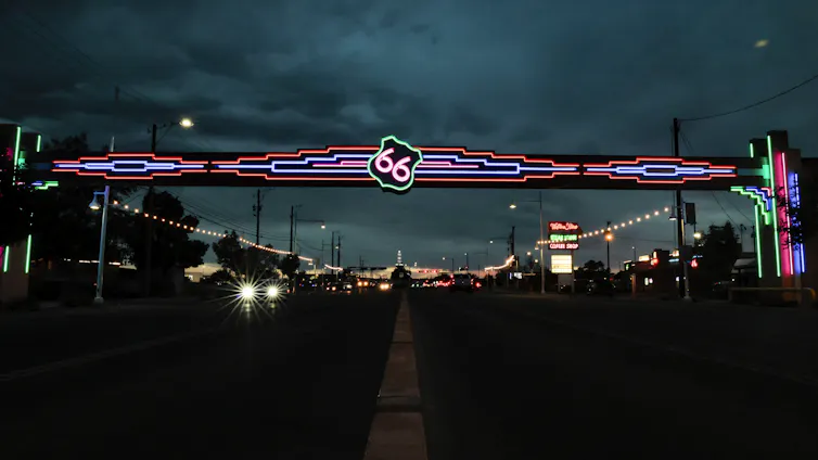
Daniel Milowski, Arizona State University
Working in concert, the American Association of State Highway Officials and the Bureau of Public Roads adopted a uniform highway numbering system and corresponding map on November 11, 1926. The numbering system and map replaced the confusing patchwork of highways and trails, like the Lincoln Highway or the Old Trails Road, with an official network of numbered highways sanctioned by federal and state highway authorities.
Since then, a small group of these highways have attained the status of cultural icon. There’s Route 1, which snakes all the way from Maine to Florida. Route 101 is celebrated for its majestic views of the Pacific Ocean, while Route 6 was immortalized in “On the Road,” Jack Kerouac’s classic novel.
The most famous, though, is arguably Route 66, nicknamed the “Main Street of America” and the “Mother Road.”
Yet as the towns that dot the highway prepare to celebrate its centennial, I’ve found myself wondering what it is, exactly, that’s being celebrated.
As a historian of Route 66, I’ve written about how there are really two versions of this 2,448-mile (3,940-kilometer) stretch of pavement.
There’s the actual highway, which reflected the 20th-century expansion of the nation’s infrastructure. Then there’s the mythic highway – a cultural icon imbued with nostalgia for a specific, 20th-century idea of romance, adventure, freedom and the American West.
There was almost no 66
As state highway commissioners in the 1920s wrangled over the specifics of the nation’s new highway system, they prized highway numbers that ended in zero, since they indicated a cross-country route. The thinking went that these routes would get the most traffic and, with it, the most business.
Oklahoma State Highway Commissioner Cyrus Avery had been a big booster for a Chicago-to-Los Angeles road in order to juice highway traffic through the Midwest. He suggested calling it Route 60, claiming a coveted cross-country number.
But commissioners from Kentucky and Virginia objected, noting that Avery’s proposed road didn’t go from coast to coast. As an alternative, they suggested 62. Avery countered with a number that he thought had a better ring to it: 66.
With the numbering controversy settled, the map of America’s first highway system was approved. But another 12 years would pass before Route 66 was fully built out, making it the first U.S. highway to be paved end to end.
Adventure, redemption and reinvention
While it took over a decade for the full, physical stretch of road to be completed, the making of the Route 66 myth began almost immediately.
Construction of the road had barely begun when Avery, John T. Woodruff and other prominent civic leaders along the highway’s path convened in January 1927 to form the U.S. Highway 66 Association to promote travel along the route.
The association began advertising Route 66 as the best West Coast travel route and even trademarked a slogan for the road, “The Main Street of America.” The association also sponsored spectacles like the Trans-American Footrace to help publicize Route 66.
The race, which started on March 4, 1928, in Los Angeles, received widespread media coverage. Reporters breathtakingly described the epic struggles of the racers, coupled with vivid descriptions of the Southwest landscape. The effect was a marriage of Route 66 to ideas of adventure and romance in America’s collective subconscious.
During the Great Depression and Dust Bowl years, thousands of migrants from the Great Plains and Midwest traveled west along Route 66, hoping to rebuild their lives in California.
Author John Steinbeck dubbed Route 66 the “Mother Road” in “The Grapes of Wrath,” likening it to an umbilical cord that delivered Oakie refugees fleeing the Dust Bowl in the Oklahoma Panhandle to a new life in California. Working for the New Deal-era Farm Security Administration, photographer Dorothea Lange documented the same Oakies fictionalized by Steinbeck. Her 1938 photograph “Family on the Road” captured a husband, wife and their two young children hitchhiking on Route 66 near Weatherford, Oklahoma, after losing their farm.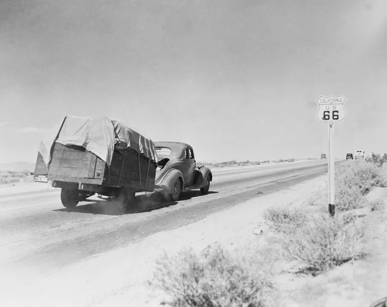
Together, Steinbeck and Lange helped imbue Route 66 with new layers of meaning tied to loss and redemption. Then, after World War II, Route 66 came to mythologize the postwar boom.
Bobby Troup’s 1946 song “(Get Your Kicks) on Route 66,” first recorded by the Nat King Cole Trio, cast the road as a postwar rite of passage. Millions of Americans went on to take family vacations to the American Southwest via Route 66, staying at roadside mom-and-pop motels, grabbing burgers at neon-lit diners and posing beside oversized roadside landmarks.
Myth versus reality
But the iconic imagery and myths of Route 66 are often at odds with the reality of the road.
I’ve come to see Troup’s song as encapsulating the tension between these two versions of Route 66.
In 1946, when Nat King Cole recorded “(Get Your Kicks on) Route 66,” Cole and his band were unable to get their own “kicks” on Route 66. That’s because few businesses located along Route 66 were willing to serve them. Jim Crow-era copies of the Green Book – a directory of businesses that would accommodate Black road trippers – show just how few options there were.
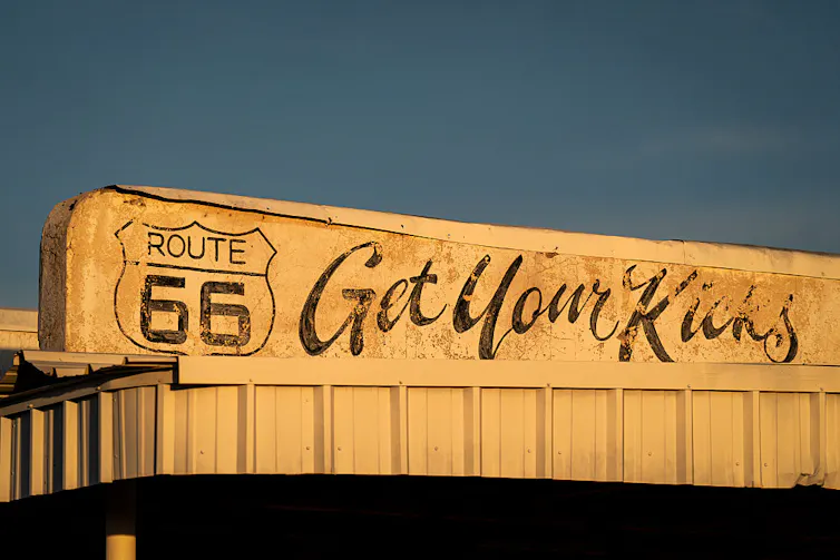
It would take passage of the Civil Rights Act of 1964 – and subsequent enforcement efforts by the Justice Department – for the travel amenities and services along Route 66 to be equally available to all Americans, regardless of their race.
Yet by the time the highway’s motels, diners, auto repair shops and gas stations were open to all travelers, Route 66’s downturn had already begun.
The 1956 Federal Aid Highway Act turbocharged the construction of new, limited-access interstate highways. These new postwar highways prioritized fast travel between major cities and their suburbs, where Americans were flocking to in large numbers.
Fast travel, however, came at the expense of small towns bypassed by the new highways, depriving many Route 66 businesses of the customers they needed to survive.
In contrast to older mom-and-pop businesses, national corporate chain motels, restaurants and gas stations dominated the new interstate highway exits. Rather than risk exposing themselves to Justice Department Civil Rights scrutiny, they made it known that they welcomed all travelers, further enticing drivers away from older establishments.
Now, as Route 66 turns 100, there’s a gap between how the road is remembered by some and how it functioned for most. Free and easy travel on the road and “getting your kicks” were limited to white Americans. Much of Route 66’s iconography emerged from early highway association marketing efforts aimed at white Americans. Few African American or Latino travelers likely feel the same nostalgia.
Today, a lot of Route 66 nostalgia has a “back to the 1950s” vibe that celebrates pre-Civil Rights America as a purer, simpler, more authentic era. This faux-authentic America better reflects the place some Americans today wish they could live in – a less complicated, less diverse land of adventure, romance and opportunity, rather than the nuanced, complicated America they actually inhabit today.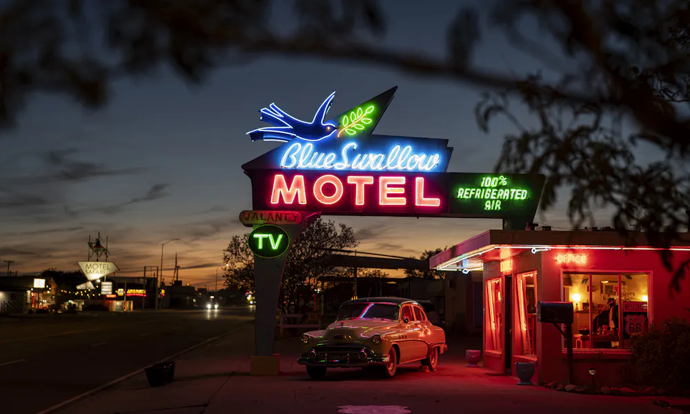
Daniel Milowski, Adjunct Professor of History, Arizona State University
This article is republished from The Conversation under a Creative Commons license. Read the original article.
📰 Enjoying STM Daily News? Join the conversation!
💬 Leave a comment, share your thoughts, and subscribe to our newsletter for the latest stories, updates, and “News You Can Use This Moment!” delivered to your inbox.
Stay connected with STM Daily News!