Is Mars really as red as people say it is? – Jasmine, age 14, Everson, Washington
People from cultures across the world have been looking at Mars since ancient times. Because it appears reddish, it has often been called the red planet. The English name for the planet comes from the Romans, who named it after their god of war because its color reminded them of blood. In reality, the reddish color of Mars comes from iron oxide in the rocks and dust covering its surface. Your blood is also red because of a mixture of iron and oxygen in a molecule called hemoglobin. So in a way, the ancient connection between the planet Mars and blood wasn’t completely wrong. Rust, which is a common form of iron oxide found here on Earth, also often has a reddish color.Iron oxide, found in rust on old metal machinery, is the compound that colors rocks and dust on Mars’ surface reddish brown.Lars Hammar/Flickr, CC BY-NC-SAIn my current research on exoplanets, I observe different types of signals from planets beyond Earth. Lots of interesting physics goes into how researchers perceive the colors of planets and stars through different types of telescopes.
Observing Mars with probes
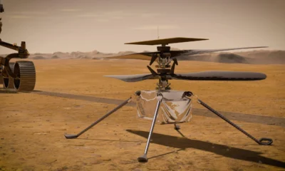
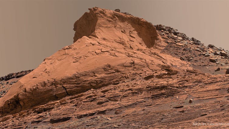
If you look closely at pictures of Mars taken by rovers on its surface, you can see that most of the planet isn’t purely red, but more of a rusty brown or tan color.You can see Mars’ rusty color in this photo taken by the Viking lander.NASA/JPL Probes sent from Earth have taken pictures showing rocks with a rusty color. A 1976 picture from the Viking lander, the very first spacecraft to land on Mars, shows the Martian ground covered with a layer of rusty orange dust. Not all of Mars’ surface has the same color. At the poles, its ice caps appear white. These ice caps contain frozen water, like the ice we usually find on Earth, but these ice caps are also covered by a layer of frozen carbon dioxide – dry ice. This layer of dry ice can evaporate very quickly when sunlight shines on it and grows back again when it becomes dark. This process causes the white ice caps to grow and shrink in size depending on the Martian seasons.This picture from the Hubble Space Telescope shows the planet with the same rusty color covering large parts of its surface.NASA, ESA, Zolt G. Levay (STScI)
Beyond visible light
Mars also gives off light in colors that you can’t see with your eyes but that scientists can measure with special cameras on telescopes. Light itself can be thought of not only as a wave but also as a stream of particles called photons. The amount of energy carried by each photon is related to its color. For example, blue and violet photons have more energy than orange and red photons.The rainbow of visible light that you can see is only a small slice of all the kinds of light. Some telescopes can detect light with a longer wavelength, such as infrared light, or light with a shorter wavelength, such as ultraviolet light. Others can detect X-rays or radio waves.Inductiveload, NASA/Wikimedia Commons, CC BY-SAUltraviolet photons have even more energy than the photons you can see with your eyes. These photons are found in direct sunlight, and because they have so much energy, they can damage the cells in your body. You can use sunscreen to protect yourself from them. Infrared photons have less energy than the photons you can see with your eyes, and you don’t need any special protection from them. This is how some types of night-vision goggles work: They can see light in the infrared spectrum as well as the visible color spectrum. Scientists can take pictures of Mars in the infrared spectrum using special cameras that work almost like night-vision goggles for telescopes.The Hubble Space Telescope could take pictures in both visible light and infrared light.NASA, James Bell (Cornell University), Justin Maki (NASA-JPL), Mike J. Wolff (SSI) The colors on the infrared picture aren’t really what the infrared light looks like, because you can’t see those colors with your eyes. They are called “false colors,” and researchers add them to look at the picture more easily. When you compare the visible color picture and the infrared picture, you can see some of the same features – and the ice caps are visible in both sets of colors.A UV view of Mars with the MAVEN spacecraft.NASA/LASP/CU Boulder NASA’s MAVEN spacecraft, launched in 2013, has even taken pictures with ultraviolet light, giving scientists a different view of both the surface of Mars and its atmosphere. Each new type of picture tells scientists more about the Martian landscape. They hope to use these details to answer questions about how Mars formed, how long it had active volcanoes, where its atmosphere came from and whether it had liquid water on its surface. Astronomers are always looking for new ways to take telescope pictures outside of the regular visible spectrum. They can even make images using radio waves, microwaves, X-rays and gamma rays. Each part of the spectrum they can use to look at an object in space represents new information they can learn from. Even though people have been looking at Mars since ancient times, we still have much to learn about this fascinating neighbor.Hello, curious kids! Do you have a question you’d like an expert to answer? Ask an adult to send your question to CuriousKidsUS@theconversation.com. Please tell us your name, age and the city where you live.And since curiosity has no age limit – adults, let us know what you’re wondering, too. We won’t be able to answer every question, but we will do our best.David Joffe, Associate Professor of Physics, Kennesaw State University This article is republished from The Conversation under a Creative Commons license. Read the original article.
Dive into “The Knowledge,” where curiosity meets clarity. This playlist, in collaboration with STMDailyNews.com, is designed for viewers who value historical accuracy and insightful learning. Our short videos, ranging from 30 seconds to a minute and a half, make complex subjects easy to grasp in no time. Covering everything from historical events to contemporary processes and entertainment, “The Knowledge” bridges the past with the present. In a world where information is abundant yet often misused, our series aims to guide you through the noise, preserving vital knowledge and truths that shape our lives today. Perfect for curious minds eager to discover the ‘why’ and ‘how’ of everything around us. Subscribe and join in as we explore the facts that matter. https://stmdailynews.com/the-knowledge/
The Building That Proved Los Angeles Could Go Vertical
Los Angeles once banned skyscrapers, yet City Hall broke the height limit and proved high-rise buildings could be engineered safely in an earthquake zone.
Last Updated on February 19, 2026 by Daily News StaffLA City Hall. Image Credit: TNC Network & Envato
How City Hall Quietly Undermined LA’s Own Height Limits
The Knowledge Series | STM Daily News
For more than half a century, Los Angeles enforced one of the strictest building height limits in the United States. Beginning in 1905, most buildings were capped at 150 feet, shaping a city that grew outward rather than upward.
The goal was clear: avoid the congestion, shadows, and fire dangers associated with dense Eastern cities. Los Angeles sold itself as open, sunlit, and horizontal — a place where growth spread across land, not into the sky.
And yet, in 1928, Los Angeles City Hall rose to 454 feet, towering over the city like a contradiction in concrete.
It wasn’t built to spark a commercial skyscraper boom. But it ended up proving that Los Angeles could safely build one.
A Rule Designed to Prevent a Manhattan-Style City
The original height restriction was rooted in early 20th-century fears:
Limited firefighting capabilities
Concerns over blocked sunlight and airflow
Anxiety about congestion and overcrowding
A strong desire not to resemble New York or Chicago
Los Angeles wanted prosperity — just not vertical density.
The height cap reinforced a development model where:
Office districts stayed low-rise
Growth moved outward
Automobiles became essential
Downtown never consolidated into a dense core
This philosophy held firm even as other American cities raced upward.
Los Angeles banned skyscrapers for decades — except one. 🏛️ While most buildings were capped at 150 feet, LA City Hall rose three times higher. This wasn’t a loophole — it was power, symbolism, and city planning shaping the skyline we know today. Why was City Hall the exception? And how did this one decision change Los Angeles forever? 📍 Forgotten LA 🧠 The Knowledge Series 📰 STM Daily News LosAngelesHistory LACityHall ForgottenLA UrbanPlanning CityPlanning LASkyline DidYouKnow HistoryTok TheKnowledge STMDailyNews ♬ original sound – STMDailyNews – STMDailyNews
Why City Hall Was Never Meant to Change the Rules
City Hall was intentionally exempt from the height limit because the law applied primarily to private commercial buildings, not civic monuments.
But city leaders were explicit about one thing: City Hall was not a precedent.
It was designed to:
Advertisement
Serve as a symbolic seat of government
Stand alone as a civic landmark
Represent stability, authority, and modern governance
Avoid competing with private office buildings
In effect, Los Angeles wanted a skyline icon — without a skyline.
Innovation Hidden in Plain Sight
What made City Hall truly significant wasn’t just its height — it was how it was built.
At a time when seismic science was still developing, City Hall incorporated advanced structural ideas for its era:
A steel-frame skeleton designed for flexibility
Reinforced concrete shear walls for lateral strength
A tapered tower to reduce wind and seismic stress
Thick structural cores that distributed force instead of resisting it rigidly
These choices weren’t about aesthetics — they were about survival.
The Earthquake That Changed the Conversation
In 1933, the Long Beach earthquake struck Southern California, causing widespread damage and reshaping building codes statewide.
Los Angeles City Hall survived with minimal structural damage.
This moment quietly reshaped the debate:
A tall building had endured a major earthquake
Structural engineering had proven effective
Height alone was no longer the enemy — poor design was
City Hall didn’t just survive — it validated a new approach to vertical construction in seismic regions.
Proof Without Permission
Despite this success, Los Angeles did not rush to repeal its height limits.
Cultural resistance to density remained strong, and developers continued to build outward rather than upward. But the technical argument had already been settled.
City Hall stood as living proof that:
High-rise buildings could be engineered safely in Los Angeles
Earthquakes were a challenge, not a barrier
Fire, structural, and seismic risks could be managed
The height restriction was no longer about safety — it was about philosophy.
The Ironic Legacy
When Los Angeles finally lifted its height limit in 1957, the city did not suddenly erupt into skyscrapers. The habit of building outward was already deeply entrenched.
The result:
Advertisement
A skyline that arrived decades late
Uneven density across the region
Multiple business centers instead of one core
Housing and transit challenges baked into the city’s growth pattern
City Hall never triggered a skyscraper boom — but it quietly made one possible.
Why This Still Matters
Today, Los Angeles continues to wrestle with:
Housing shortages
Transit-oriented development debates
Height and zoning battles near rail corridors
Resistance to density in a growing city
These debates didn’t begin recently.
They trace back to a single contradiction: a city that banned tall buildings — while proving they could be built safely all along.
Los Angeles City Hall wasn’t just a monument. It was a test case — and it passed.
Why Downtown Los Angeles Feels Small Compared to Other Cities
Downtown Los Angeles often feels “small” compared to other U.S. cities, but that’s only part of the story. With some of the tallest buildings west of the Mississippi and skyline clusters spread across the region, LA’s downtown reflects the city’s unique polycentric identity—one that, if combined, could form a true mega downtown.
Panorama of Los Angeles from Mount Hollywood – California, United States
When people think of major American cities, they often imagine a bustling, concentrated downtown core filled with skyscrapers. New York has Manhattan, Chicago has the Loop, San Francisco has its Financial District. Los Angeles, by contrast, often leaves visitors surprised: “Is this really downtown?”
The answer is yes—and no.
Downtown LA in Context
Compared to other major cities, Downtown Los Angeles (DTLA) is relatively small as a central business district. For much of the 20th century, strict height restrictions capped most buildings under 150 feet, while cities like Chicago and New York were erecting early skyscrapers. LA’s skyline didn’t really begin to climb until the late 1960s.
But history alone doesn’t explain why DTLA feels different. The real story lies in how Los Angeles grew: not as one unified city center, but as a collection of many hubs.
Downtown Los Angeles
A Polycentric City
Los Angeles is famously decentralized. Hollywood developed around the film industry. Century City rose on former studio land as a business hub. Burbank became a studio and aerospace center. Long Beach grew around the port. The Wilshire Corridor filled with office towers and condos.
Unlike other cities where downtown is the place for work, culture, and finance, Los Angeles spread its energy outward. Freeways and car culture made it easy for businesses and residents to operate outside of downtown. The result is a polycentric metropolis, with multiple “downtowns” rather than one dominant core.
A Resident’s Perspective
As someone who lived in Los Angeles for 28 years, I see DTLA differently. While some outsiders describe it as “small,” the reality is that Downtown Los Angeles is still significant. It has some of the tallest buildings west of the Mississippi River, including the Wilshire Grand Center and the U.S. Bank Tower. Over the last two decades, adaptive reuse projects have transformed old office buildings into lofts, while developments like LA Live, Crypto.com Arena, and the Broad Museum have revitalized the area.
In other words, DTLA is large enough—it just plays a different role than downtowns in other American cities.
View of Westwood, Century City, Beverly Hills, and the Wilshire Corridor.
The “Mega Downtown” That Isn’t
A friend once put it to me with a bit of imagination: “If you could magically pick up all of LA’s skyline clusters—Downtown, Century City, Hollywood, the Wilshire Corridor—and drop them together in one spot, you’d have a mega downtown.”
He’s right. Los Angeles doesn’t lack tall buildings or urban energy—it just spreads them out over a vast area, reflecting the city’s unique history, geography, and culture.
Advertisement
A Downtown That Fits Its City
So, is Downtown LA “small”? Compared to Manhattan or Chicago’s Loop, yes. But judged on its own terms, DTLA is a vibrant hub within a much larger, decentralized metropolis. It’s a downtown that reflects Los Angeles itself: sprawling, diverse, and impossible to fit neatly into the mold of other American cities.
Dive into “The Knowledge,” where curiosity meets clarity. This playlist, in collaboration with STMDailyNews.com, is designed for viewers who value historical accuracy and insightful learning. Our short videos, ranging from 30 seconds to a minute and a half, make complex subjects easy to grasp in no time. Covering everything from historical events to contemporary processes and entertainment, “The Knowledge” bridges the past with the present. In a world where information is abundant yet often misused, our series aims to guide you through the noise, preserving vital knowledge and truths that shape our lives today. Perfect for curious minds eager to discover the ‘why’ and ‘how’ of everything around us. Subscribe and join in as we explore the facts that matter. https://stmdailynews.com/the-knowledge/
A young George Washington was thrust into the dense, contested wilderness of the Ohio River Valley as a land surveyor for real estate development companies in Virginia. Henry Hintermeister/Public domain via Wikimedia Commons
This Presidents Day, I’ve been thinking about George Washington − not at his finest hour, but possibly at his worst.
In 1754, a 22-year-old Washington marched into the wilderness surrounding Pittsburgh with more ambition than sense. He volunteered to travel to the Ohio Valley on a mission to deliver a letter from Robert Dinwiddie, governor of Virginia, to the commander of French troops in the Ohio territory. This military mission sparked an international war, cost him his first command and taught him lessons that would shape the American Revolution.
As a professor of early American history who has written two books on the American Revolution, I’ve learned that Washington’s time spent in the Fort Duquesne area taught him valuable lessons about frontier warfare, international diplomacy and personal resilience.
The mission to expel the French
In 1753, Dinwiddie decided to expel French fur trappers and military forces from the strategic confluence of three mighty waterways that crisscrossed the interior of the continent: the Allegheny, Monongahela and Ohio rivers. This confluence is where downtown Pittsburgh now stands, but at the time it was wilderness.
King George II authorized Dinwiddie to use force, if necessary, to secure lands that Virginia was claiming as its own.
As a major in the Virginia provincial militia, Washington wanted the assignment to deliver Dinwiddie’s demand that the French retreat. He believe the assignment would secure him a British army commission.
Washington received his marching orders on Oct. 31, 1753. He traveled to Fort Le Boeuf in northwestern Pennsylvania and returned a month later with a polite but firm “no” from the French.George Washington held an honorary commission as a major in the British army prior to the French and Indian War. Dea/M. Seemuller/De Agostini collection/Getty Images
Dinwiddie promoted Washington from major to lieutenant colonel and ordered him to return to the Ohio River Valley in April 1754 with 160 men. Washington quickly learned that French forces of about 500 men had already constructed the formidable Fort Duquesne at the forks of the Ohio. It was at this point that he faced his first major test as a military leader. Instead of falling back to gather more substantial reinforcements, he pushed forward. This decision reflected an aggressive, perhaps naive, brand of leadership characterized by a desire for action over caution.
Washington’s initial confidence was high. He famously wrote to his brother that there was “something charming” in the sound of whistling bullets.
The Jumonville affair and an international crisis
Perhaps the most controversial moment of Washington’s early leadership occurred on May 28, 1754, about 40 miles south of Fort Duquesne. Guided by the Seneca leader Tanacharison – known as the “Half King” – and 12 Seneca warriors, Washington and his detachment of 40 militiamen ambushed a party of 35 French Canadian militiamen led by Ensign Joseph Coulon de Jumonville. The Jumonville affair lasted only 15 minutes, but its repercussions were global.The Jumonville affair became the opening battle of the French and Indian War. Interim Archives/Archive Collection/Getty Images
Ten of the French, including Jumonville, were killed. Washington’s inability to control his Native American allies – the Seneca warriors executed Jumonville – exposed a critical gap in his early leadership. He lacked the ability to manage the volatile intercultural alliances necessary for frontier warfare.
Washington also allowed one enemy soldier to escape to warn Fort Duquesne. This skirmish effectively ignited the French and Indian War, and Washington found himself at the center of a burgeoning international crisis.
Advertisement
Defeat at Fort Necessity
Washington then made the fateful decision to dig in and call for reinforcements instead of retreating in the face of inevitable French retaliation. Reinforcements arrived: 200 Virginia militiamen and 100 British regulars. They brought news from Dinwiddie: congratulations on Washington’s victory and his promotion to colonel.
His inexperience showed in his design of Fort Necessity. He positioned the small, circular palisade in a meadow depression, where surrounding wooded high ground allowed enemy marksmen to fire down with impunity. Worse still, Tanacharison, disillusioned with Washington’s leadership and the British failure to follow through with promised support, had already departed with his warriors weeks earlier. When the French and their Native American allies finally attacked on July 3, heavy rains flooded the shallow trenches, soaking gunpowder and leaving Washington’s men vulnerable inside their poorly designed fortification.Washington was outnumbered and outmaneuvered at Fort Necessity. Interim Archives/Archive Collection/Getty Images
The battle of Fort Necessity was a grueling, daylong engagement in the mud and rain. Approximately 700 French and Native American allies surrounded the combined force of 460 Virginian militiamen and British regulars. Despite being outnumbered and outmaneuvered, Washington maintained order among his demoralized troops. When French commander Louis Coulon de Villiers – Jumonville’s brother – offered a truce, Washington faced the most humbling moment of his young life: the necessity of surrender. His decision to capitulate was a pragmatic act of leadership that prioritized the survival of his men over personal honor.
The surrender also included a stinging lesson in the nuances of diplomacy. Because Washington could not read French, he signed a document that used the word “l’assassinat,” which translates to “assassination,” to describe Jumonville’s death. This inadvertent admission that he had ordered the assassination of a French diplomat became propaganda for the French, teaching Washington the vital importance of optics in international relations.A log cabin used to protect the perishable supplies still stands at Fort Necessity today. MyLoupe/Universal Images Group/Getty Images
Lessons that forged a leader
The 1754 campaign ended in a full retreat to Virginia, and Washington resigned his commission shortly thereafter. Yet, this period was essential in transforming Washington from a man seeking personal glory into one who understood the weight of responsibility.
He learned that leadership required more than courage – it demanded understanding of terrain, cultural awareness of allies and enemies, and political acumen. The strategic importance of the Ohio River Valley, a gateway to the continental interior and vast fur-trading networks, made these lessons all the more significant.
Ultimately, the hard lessons Washington learned at the threshold of Fort Duquesne in 1754 provided the foundational experience for his later role as commander in chief of the Continental Army. The decisions he made in Pennsylvania and the Ohio wilderness, including the impulsive attack, the poor choice of defensive ground and the diplomatic oversight, were the very errors he would spend the rest of his military career correcting.
Though he did not capture Fort Duquesne in 1754, the young George Washington left the woods of Pennsylvania with a far more valuable prize: the tempered, resilient spirit of a leader who had learned from his mistakes.
Dive into “The Knowledge,” where curiosity meets clarity. This playlist, in collaboration with STMDailyNews.com, is designed for viewers who value historical accuracy and insightful learning. Our short videos, ranging from 30 seconds to a minute and a half, make complex subjects easy to grasp in no time. Covering everything from historical events to contemporary processes and entertainment, “The Knowledge” bridges the past with the present. In a world where information is abundant yet often misused, our series aims to guide you through the noise, preserving vital knowledge and truths that shape our lives today. Perfect for curious minds eager to discover the ‘why’ and ‘how’ of everything around us. Subscribe and join in as we explore the facts that matter. https://stmdailynews.com/the-knowledge/