

The Knowledge
Population Density: How Los Angeles Compares to New York and Chicago
How dense are America’s biggest cities? A clear breakdown of population density in Los Angeles, New York City, and Chicago—city limits vs metro areas—and why it matters.

Population Density: How Los Angeles Compares to New York and Chicago
When people think of crowded American cities, New York City usually comes to mind first. Los Angeles, by contrast, is often labeled as “sprawling,” while Chicago is seen as a middle ground. But population density tells a more nuanced story—especially when comparing city proper numbers versus metro-area density.
City Proper: How Dense Are the Cities Themselves?
Looking only at official city boundaries, the differences are stark:
New York City averages about 27,000–28,000 people per square mile, making it by far the most densely populated major city in the United States.
Chicago comes in at roughly 12,000 people per square mile, dense but far more spread out than New York.
Los Angeles, despite being the nation’s second-largest city by population, averages just 8,400–8,500 people per square mile.
This gap reflects development patterns. New York grew upward with dense apartment buildings and extensive transit. Los Angeles expanded outward with single-family neighborhoods and car-oriented planning.
Metro Areas Tell a Different Story
When the lens widens to include surrounding suburbs and commuter communities, the rankings shift:
Los Angeles Metro Area: ~7,000 people per square mile
New York Metro Area: ~5,300 people per square mile
Chicago Metro Area: ~3,500 people per square mile
This surprises many readers. While New York’s core is extremely dense, its metro region stretches across a vast, lower-density area spanning parts of New York, New Jersey, and Pennsylvania. Los Angeles, on the other hand, has a metro region that is more consistently built-up, with fewer truly rural gaps.
Why Density Feels Different in Each City
Population density doesn’t always match perception:
New York feels crowded because density is concentrated vertically and transit funnels millions into compact areas.
Los Angeles feels congested not because of extreme density, but because people are spread out and heavily reliant on cars.
Chicago balances both, with dense neighborhoods near the core and more traditional suburban sprawl outward.
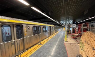
Hollywood vs. Reality: How LA’s Wilshire Subway Was Really Built
Why This Matters
Density shapes:
Transportation planning
Housing affordability
Infrastructure costs
Environmental impact
For cities like Los Angeles—now reinvesting in rail, buses, and transit-oriented development—understanding density is critical. As coverage on LA Metro and urban revival continues, these numbers explain why transit challenges in Southern California differ so sharply from those in New York or Chicago.
The Big Picture
Most dense city: New York City
Most dense metro area: Los Angeles
Most balanced: Chicago
Density isn’t just about how many people live in a place—it’s about how they live, move, and interact with the city around them.
Further Reading: Population Density & Urban Development
- U.S. Census Bureau – Urban vs. Rural and Urbanized Area Density
- U.S. Census Bureau – Population and Density Data for U.S. Cities
- New Geography – Density Rankings of Major U.S. Urban Areas
- Brookings Institution – Urban and Metropolitan Policy Research
- Planetizen – What Population Density Means in Urban Planning
Dive into “The Knowledge,” where curiosity meets clarity. This playlist, in collaboration with STMDailyNews.com, is designed for viewers who value historical accuracy and insightful learning. Our short videos, ranging from 30 seconds to a minute and a half, make complex subjects easy to grasp in no time. Covering everything from historical events to contemporary processes and entertainment, “The Knowledge” bridges the past with the present. In a world where information is abundant yet often misused, our series aims to guide you through the noise, preserving vital knowledge and truths that shape our lives today. Perfect for curious minds eager to discover the ‘why’ and ‘how’ of everything around us. Subscribe and join in as we explore the facts that matter. https://stmdailynews.com/the-knowledge/
Discover more from Daily News
Subscribe to get the latest posts sent to your email.


Forgotten Genius Fridays
Forgotten Genius Friday: The Gas Mask and the Man Who Invented It
Garrett Morgan, the inventor behind the modern gas mask and traffic signal, risked his life in 1916 to save workers trapped in a tunnel explosion beneath Cleveland. Though his invention worked and lives were saved, the media largely erased his name because he was Black. This is the story of a hero history tried to forget.
Last Updated on March 27, 2026 by Daily News Staff
🎥 The Knowledge – Episode: Garrett Morgan
“The man who gave us stoplights also saved lives underground.”
Before Garrett Morgan became known for inventing the three-position traffic signal, he was already changing the world—one breath at a time.
In 1912, Morgan designed a safety hood to protect firefighters and miners from the deadly smoke and toxic fumes they faced on the job. This early version of the gas mask featured breathing tubes and a wet sponge to filter air—simple, yet revolutionary.
But the true test came in 1916, when a natural gas explosion rocked a tunnel under Lake Erie in Cleveland. With little hesitation, Morgan donned his invention and entered the chaos. He saved multiple workers trapped beneath the earth—risking his own life to prove his device could do what others hadn’t even imagined.
Despite his heroism, headlines of the day often left out his name. Why? Because Garrett Morgan was Black. His contributions were buried in the shadows of racial prejudice, even as his inventions were saving lives and modernizing cities.
Today, we’re changing that narrative.
Garrett Morgan didn’t just invent the gas mask—he proved it worked. And his legacy deserves to breathe.
🧠 Now you know.
Related Links:
The Forgotten Genius Behind the Gas Mask – YouTube Short
Who Was Garrett Morgan? – Biography
More “Forgotten Genius Friday” Episodes
📢 Watch the full 60-second episode on our YouTube series, “The Knowledge,” and help us give credit where it’s due.
Author
Discover more from Daily News
Subscribe to get the latest posts sent to your email.
The Knowledge
Why Phoenix’s Skyline Has Stayed Low — And How It Compares to Los Angeles
Discover why Phoenix’s skyline lacks supertall skyscrapers, from FAA flight path limits near Phoenix Sky Harbor International Airport to how it compares with Los Angeles’s skyline growth.
Last Updated on March 25, 2026 by Daily News Staff
Phoenix is the fifth-largest city in the United States, yet its skyline doesn’t resemble other major metros like Los Angeles, Chicago, or Dallas. Despite rapid population and economic growth, downtown Phoenix has long lacked supertall skyscrapers — and until recently, didn’t even have a building tall enough to qualify as a true “skyscraper” under standard definitions.
The Basics: Phoenix’s Height Reality
The tallest structure in Phoenix for decades has been Chase Tower, rising to about 483 feet. Under the Council on Tall Buildings and Urban Habitat definition, a skyscraper reaches at least 492 feet — which means Phoenix has technically lacked one — despite its size and population.
A new project, the Astra Tower, is planned to rise around 540+ feet when it breaks ground, potentially giving Phoenix its first true skyscraper.
Airport Proximity: The FAA’s Height Grid
FAA Obstacle Evaluation & Downtown Limits
Phoenix’s skyline constraints are rooted in aviation safety.
📍 Phoenix Sky Harbor International Airport sits just a few miles from downtown.
- The Federal Aviation Administration (FAA) regulates building heights near airports so they don’t obstruct flight paths, require planes to alter approaches, or interfere with climb-out safety.
- In Phoenix, this results in a layered set of height limits that vary by location and elevation above sea level — often measured in feet above mean sea level (MSL) rather than simply building height from ground.
The city’s zoning code divides downtown into multiple contour zones with distinct maximum elevation values (e.g., 1,275 ft, 1,525 ft, 1,700 ft MSL), each tied to how close it sits under airport flight paths.
That means in some blocks you can’t build above a specific elevation even if ground levels are lower — a regulatory “roof” that varies across downtown.
City zoning also explicitly states that no building can exceed the FAA’s airport height limits, even if other bonuses or zoning allowances exist.
Phoenix vs. Los Angeles: A Quick Comparison
Los Angeles: Higher Limits, Different Constraints
Cities like Los Angeles also have nearby airports (e.g., Los Angeles International Airport), but their key business districts aren’t directly under major flight corridors.
LA’s downtown has:
- Taller office and residential towers
- A financial core with dense development
- Fewer FAA-driven overlays because the flight paths stretch past the downtown edge
Los Angeles’s tallest buildings — including Wilshire Grand Center (~1,100 ft) and U.S. Bank Tower (~1,018 ft) — were built where FAA restrictions don’t force low ceilings. FAA evaluations were conducted but didn’t cut as deeply into downtown zoning compared to Phoenix.
Phoenix, by contrast, sits right under approach and departure corridors — leading to consistent FAA involvement in almost every proposed mid- or high-rise downtown.
Economic and Planning Philosophies
Beyond FAA rules:
- Phoenix developed in the automobile era, with vast inexpensive land encouraging horizontal growth.
- Los Angeles grew earlier with heavier investment in centralized neighborhoods and higher density.
- Phoenix’s village plan long encouraged multiple smaller hubs instead of concentrating all growth in one downtown core.
These historical differences mean Phoenix didn’t have the same economic “pressure” to build up — even with zoning that allows significant height if FAA permits are met.
What This Means for Phoenix’s Future
Phoenix still has room to grow vertically — but:
- FAA height contours will remain the ceiling unless flight paths change
- Developers must secure determinations of no hazard from the FAA before going taller
- New projects like Astra show demand for taller buildings is rising
As Phoenix’s urban core densifies and land becomes scarcer, its skyline may yet reach higher — but always within the invisible grid drawn by aviation safety.
Related External Links
- Phoenix Sky Harbor International Airport Official Website
- FAA Obstruction Evaluation / Airport Airspace Analysis (OE/AAA)
- City of Phoenix Planning & Development Department
- Council on Tall Buildings and Urban Habitat (CTBUH)
- Los Angeles World Airports (LAX Authority)
- Phoenix Skyscraper Database & Diagrams
- Los Angeles Skyscraper Database & Diagrams
Dive into “The Knowledge,” where curiosity meets clarity. This playlist, in collaboration with STMDailyNews.com, is designed for viewers who value historical accuracy and insightful learning. Our short videos, ranging from 30 seconds to a minute and a half, make complex subjects easy to grasp in no time. Covering everything from historical events to contemporary processes and entertainment, “The Knowledge” bridges the past with the present. In a world where information is abundant yet often misused, our series aims to guide you through the noise, preserving vital knowledge and truths that shape our lives today. Perfect for curious minds eager to discover the ‘why’ and ‘how’ of everything around us. Subscribe and join in as we explore the facts that matter. https://stmdailynews.com/the-knowledge/
Discover more from Daily News
Subscribe to get the latest posts sent to your email.

If you live in Arizona, chances are you’ve seen or heard about javelinas roaming neighborhoods, especially at dawn or dusk. But what exactly are these animals—and are they dangerous?
Javelinas, officially known as collared peccaries, are often mistaken for wild pigs. However, they’re actually a completely different species native to the Americas.
@stmblog They look like pigs… but they’re not 🐗❌ Meet Arizona’s javelinas! hhtps://stmdailynews.com #Javelina #ArizonaWildlife #PhoenixAZ #DesertLife #WildlifeFacts #NowYouKnow #STMdailynews #UrbanWildlife #DidYouKnow #NatureExplained ♬ original sound – STMDailyNews
Not a Pig: Meet the Collared Peccary
The collared peccary (Pecari tajacu) is a small, hoofed mammal with a stocky build and coarse, bristly fur. They get their nickname “javelina” from Spanish, meaning “little javelin,” referring to their sharp tusks.
- Length: 3–4 feet
- Weight: 40–60 pounds
- Color: Gray to black with a lighter “collar”
- Distinct trait: Strong musky odor from a scent gland
Where Do Javelinas Live?
Javelinas thrive in desert environments and are commonly found across Arizona, including the Phoenix metro area. As urban development expands, encounters with humans have become more frequent.
Behavior: Why You See Them in Groups
Javelinas are social animals that travel in groups called “squadrons,” typically made up of 6 to 12 individuals. These groups help protect them from predators and navigate their environment.
They are most active during cooler parts of the day—early morning and evening—especially during Arizona’s hot summers.
What Do Javelinas Eat?
Despite their tough appearance, javelinas are herbivores. Their diet mainly includes:
- Prickly pear cactus (a favorite)
- Mesquite beans
- Roots and desert vegetation
Are Javelinas Dangerous?
Javelinas are generally not aggressive toward humans, but they can become defensive if they feel threatened—especially if they are protecting their young or are approached by dogs.
Important safety tips:
- Do not feed javelinas
- Keep pets on a leash
- Secure trash and outdoor food sources
- Give them plenty of space
Why Are They Showing Up in Neighborhoods?
Urban expansion into desert habitats has increased human-wildlife interactions. Easy access to food—like garbage, pet food, and landscaping plants—also attracts javelinas into residential areas.
Final Thoughts
Javelinas are an important part of the desert ecosystem and usually pose little risk when left alone. Understanding their behavior is the key to peacefully coexisting with these unique animals.
Related External Links & Further Reading
- Arizona Game & Fish Department – Living With Javelina
- National Park Service – Javelina (Saguaro National Park)
- Arizona-Sonora Desert Museum – Javelina Natural History
- Encyclopaedia Britannica – Peccary Overview
- Texas Parks & Wildlife – Collared Peccary
Dive into “The Knowledge,” where curiosity meets clarity. This playlist, in collaboration with STMDailyNews.com, is designed for viewers who value historical accuracy and insightful learning. Our short videos, ranging from 30 seconds to a minute and a half, make complex subjects easy to grasp in no time. Covering everything from historical events to contemporary processes and entertainment, “The Knowledge” bridges the past with the present. In a world where information is abundant yet often misused, our series aims to guide you through the noise, preserving vital knowledge and truths that shape our lives today. Perfect for curious minds eager to discover the ‘why’ and ‘how’ of everything around us. Subscribe and join in as we explore the facts that matter. https://stmdailynews.com/the-knowledge/
Author
Discover more from Daily News
Subscribe to get the latest posts sent to your email.


